
Build on precise indoor position
Add camera-based positioning to your navigation app, AR experience or digital twin, in any space Seekr has mapped.
Talk to us about accessSeekr is the precise positioning layer for airports, stations, malls and anywhere GPS fails. A phone camera recognises the venue and works out exact position, floor and heading. No beacons, no Wi-Fi, nothing to install.
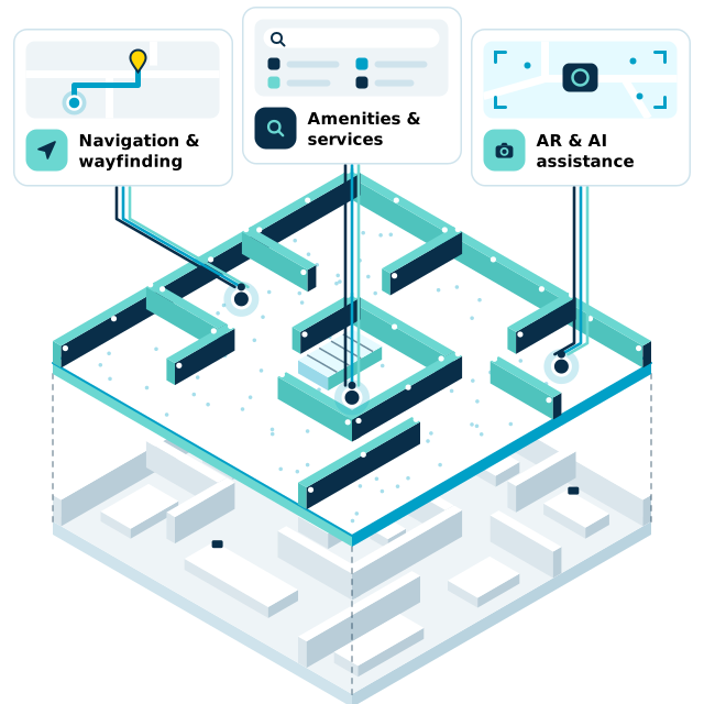
Platform
GPS gave the outdoors a shared coordinate system that every map, ride and delivery app builds on. Airports, stations, malls and dense city blocks never got one. Seekr gives any scanned space a precise, camera-based position that apps, venues and partners can build on.
Position, floor and facing direction from what the camera sees, deep inside buildings and between towers.
No beacons to install, power or maintain. The map of the venue is the only infrastructure.
Live footage is compared with the scan to spot changes in the venue, so the map keeps up.
Standard reality-capture scanners map a venue far faster than traditional mapping systems.
Technology

The phone camera picks out landmarks in each frame.

They’re matched against the venue’s scanned 3D map.

Seekr works out exactly where the user stands, on which floor, and which way they face.

On-screen, audio or haptic directions, plus anonymous movement data for the operator.
Beacons and Wi-Fi guess position from signal strength, so accuracy depends on hardware someone has to install and maintain. A camera recognises the venue itself.
Deployment
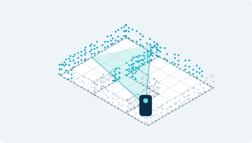
Standard reality-capture scanners capture the venue. Nothing is installed.

Our algorithms turn the scan into a precise spatial map.

Visitors open it from a QR code. Operators see live movement data.
Solutions
Add camera-based positioning to your navigation app, AR experience or digital twin, in any space Seekr has mapped.
Talk to us about accessAirports, transit hubs, museums, malls and events. Visitors find their way from a QR code, and you get anonymous movement data to plan around.
Book a demoCompare
Staff and printed signs can’t keep up as venues change, and the technology on offer needs hardware or loses accuracy.
| Bluetooth beacons | Wi-Fi positioning | Indoor mapping appse.g. GoodMaps, aryve | Seekr | |
|---|---|---|---|---|
| No hardware in the venue | ||||
| Self-updating maps | ||||
| Accuracy | ~1–3 m typical | ~5–15 m typical | Sub-metre | Sub-metre |
| Fast, low-cost mapping | ||||
| Live data on visitor movement |
A dash means it varies by vendor and venue, or is not published.
Demo
Real journeys recorded at Hong Kong International Airport, guided by the phone’s camera alone.

So precise, even blind users can follow it.
Supported by







Sub-metre. Seekr returns position, floor and the direction the user is facing, from the phone camera alone.
No. The venue is captured once with standard reality-capture scanners. There are no beacons or Wi-Fi access points to install or maintain.
In our airport pilot, 120,000 m² went from first scan to working navigation in about two weeks.
No personal data is needed. Seekr runs in the cloud, a private cloud or offline, and the operator owns the data.
Yes. Seekr is built to be the positioning layer other products use. Tell us what you’re building and we’ll walk you through integration.
See Seekr in action, or tell us what you want to build.